
Do you find yourself struggling with geospatial data in your database? You know the feeling: you need quick answers about locations, distances, and relationships between points on a map, but your database just wasn’t built for these questions.
The problem? While fantastic for traditional data, PostgreSQL on its own doesn’t natively handle the complexities of maps and coordinates.
PostGIS fixes that.
PostGIS transforms PostgreSQL into a spatial powerhouse. It adds native support for location data, letting you run complex spatial queries without patching together awkward solutions or using separate systems.
If geospatial data plays a role in what you do, you don’t just want PostGIS; you need it.
Ever tried forcing PostgreSQL to handle location data without the right tools? It’s frustrating. Your queries crawl, results might lack precision, and writing even basic spatial logic becomes a headache that grows with your data.
PostGIS eliminates these problems by bringing spatial capabilities directly into PostgreSQL. No more workarounds or separate systems, just your database speaking the language of maps and locations.
You can run queries like:
It’s not just about storing location data. PostGIS gives you the ability to ask real questions of it and actually get answers, fast.
Whether you’re tracking assets, planning infrastructure, analyzing service areas, or powering location-based features, PostGIS gives PostgreSQL the capabilities to handle it all.
You’re probably already using PostgreSQL for your applications or analytics. But without PostGIS, you’re missing a key capability. Here’s how PostGIS transforms your ability to work with location data in real-world situations:
Geospatial data is notoriously heavy. Trying to filter, sort, or analyze it without spatial indexing leads to slow queries and overloaded servers.
PostGIS solves this with specialized spatial indexes built for geographic operations. The result? Lightning-fast queries on complex location data, no extra systems or workarounds needed.
Are you currently syncing data to a separate GIS platform just to run spatial operations? That approach creates data silos, sync headaches, and more infrastructure to babysit.
With PostGIS, everything stays in PostgreSQL. Your location data lives right alongside your business data, giving you a single source of truth and less complexity to manage.
If you’re running Kubernetes, microservices, or cloud deployments, traditional GIS solutions often feel like square pegs in round holes. PostGIS integrates seamlessly with containerized PostgreSQL and works perfectly with tools like Percona Operator for PostgreSQL.
This means your spatial data can scale alongside your applications without special handling or odd infrastructure exceptions.
If you work in government, utilities, healthcare, telecom, or financial services, you know the importance of data accuracy and compliance. PostGIS gives you precise spatial operations while keeping your location data inside your secure, auditable database environment, right where your other sensitive data lives.
Many proprietary GIS tools charge extra for spatial capabilities or limit usage by user count or query volume. PostGIS is fully open source, which means no extra licenses and no unexpected bills when you scale up your spatial operations.
PostGIS is open source and widely supported, but how you use it in production makes a big difference. Depending on your setup and team capacity, there are a few paths forward.
Yes, you can install PostGIS yourself using standard package managers, but going this route means taking on the full responsibility for its integration.
That includes:
This works fine if you have the time and expertise, but it adds operational overhead your team has to absorb.
Using multiple PostgreSQL extensions? While powerful, they can conflict if not managed carefully. Avoid integration headaches! Download our PostgreSQL Extension Handbook for proven strategies to ensure your extensions work seamlessly together.
Some proprietary PostgreSQL distributions include PostGIS, which might seem convenient. But before jumping in, ask yourself:
If you’re looking to avoid lock-in or inflated licensing costs, this path might not give you the control you need long term.
Percona includes PostGIS as part of its enterprise-ready PostgreSQL distribution, so there are no license fees, no extra installation steps, and no need to worry about whether your extensions will play nicely together.
With this option, you get:
It’s everything you need to run spatial workloads at scale, minus the complexity of rolling your own or the limitations of commercial forks.
If you’re working with coordinates, shapes, or anything location-aware, you already know the limits of a traditional database setup.
Before you take on more custom code, sync jobs, or bolt-on GIS systems, it’s worth asking:
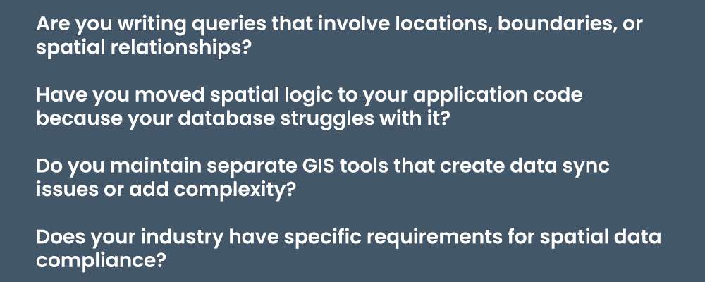
These are exactly the challenges PostGIS was built to solve. And when it’s already part of your PostgreSQL environment with support that actually understands spatial data, you get one less thing to worry about.
Choosing Percona for PostgreSQL means PostGIS isn’t just an add-on; it’s a core part of a tested, integrated database environment. You gain the power of spatial analysis without the integration headaches or operational burdens of a DIY setup, without the vendor lock-in or hidden costs of proprietary forks.
You don’t need to invest in a separate GIS platform or rely on custom workarounds. With PostGIS included in Percona for PostgreSQL, your geospatial data is fast, accurate, and production-ready, right from the start.
PostGIS gives PostgreSQL the spatial capabilities your applications demand. To avoid other performance and reliability gaps in enterprise production, download our free guide:

PostGIS is an open source extension that adds geospatial capabilities to PostgreSQL. It allows the database to store, query, and analyze geographic and geometric data like coordinates, polygons, and distances. With PostGIS, PostgreSQL becomes a full-featured spatial database, supporting use cases in GIS, logistics, infrastructure, and location-based services.
PostGIS lets you run spatial queries directly inside PostgreSQL, keeping your location and business data in one place. This eliminates the need for external GIS platforms, reduces data sync complexity, and simplifies infrastructure. It also scales better with cloud-native and containerized applications.
Yes — PostGIS is widely used in production across industries like government, telecom, healthcare, and logistics. It offers high-performance spatial indexes, precise geometric calculations, and compliance-friendly data storage within PostgreSQL. When paired with high availability and monitoring tools, it’s fully enterprise-ready.
Yes. PostGIS works well with containerized PostgreSQL deployments, including those managed by Kubernetes operators like the Percona Operator for PostgreSQL. This makes it a great fit for scalable, cloud-native apps that depend on geospatial data.